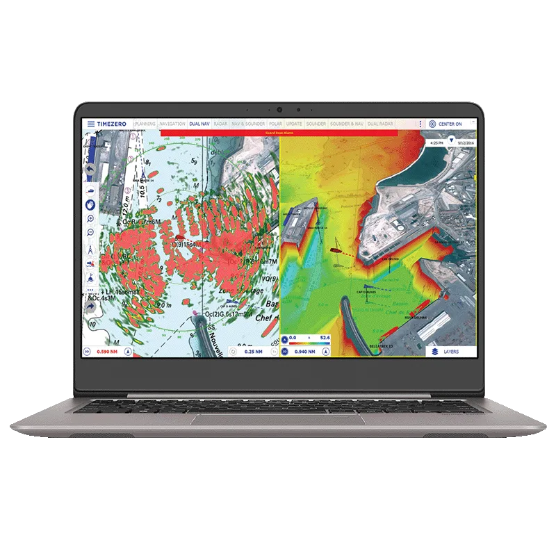
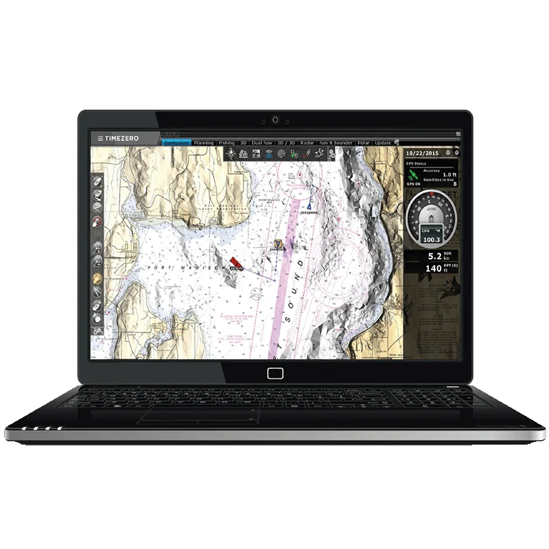
Professional interface
Customisable workspaces, toolbars, ribbons and NavData panels that can be saved and recalled.
TIMEZERO · Navigation Software & ECS
The navigation solution for professionals who demand excellence at sea
Advanced TIMEZERO navigation software for professional mariners, with seamless charts, S-63 compatibility, weather and ocean data and FURUNO integration.
Price and availability on request. We handle supply, installation and support.
TZ PROFESSIONAL is TIMEZERO navigation software built for commercial fishing, workboats, racing and sport fishing. The Chart Engine delivers smooth 2D and 3D charts with no redraw time, PhotoFusion blends satellite photos with raster or vector charts, and official S-63 charts are supported. Customisable workspaces, toolbars and NavData panels adapt to your workflow, across up to three independent workspaces on multiple screens.
Route management with a depth-based safety check, tide and current data, worldwide forecasts up to 15 days and Ocean-O oceanographic layers support safer passage decisions, while the Profile Window shows the seabed along any track or divider line. A dedicated Fisheries workspace, bottom hardness analysis and trawl positioning serve fishing operations, and a modular architecture adds Furuno Sounder, Multibeam, Radar and Augmented Reality. It complies with USCG NVIC 01-16 CHG 3, RTCM-SC109 and the UK MCA SV-ECS framework.
Customisable workspaces, toolbars, ribbons and NavData panels that can be saved and recalled.
Official S-63 chart compatibility and compliance with new ECS regulations.
Up to 3 independent workspaces across multiple screens.
Forecasts up to 15 days, with altimetry, sea surface temperature and ocean current layers.
Depth or hardness shading, contour lines, PBG and trawl positioning tools.
Live target tracking, unlimited track recording and anti-collision alarms.
| Chart engine | Exclusive TIMEZERO Chart Engine (2D and 3D view, seamless chart redraw), TIMEZERO PhotoFusion |
|---|---|
| Chart compatibility | Official S-63 charts, mm3d raster or vector charts (from manufacturers such as C-MAP or MapMedia), TZ MAPS |
| Depth and bathymetry | Depth shading; mm3d high-resolution 3D bathy on selected areas (optional) |
| Route planning | Advanced Route Planning Wizard (departure time optimisation according to tidal current), route safety check, print route |
|---|---|
| Safety | Anti-grounding cone, Digital Selective Calling (DSC) and Man Over Board (MOB), Search & Rescue (SAR) route patterns |
| Alarms | Anchor, CPA/TCPA, depth and more; lost sensor alarm; own ship and target alarm zones; Alarm Zone NavData |
| Fuel management | Fuel range ring, route warning, distance to empty, time to empty |
| Fleet and events | Fleet tracking (PosRep files), advanced events management, Event NavData, Quick Action NavData |
| AIS and MARPA | Target display with targets list, graphic CPA, advanced AIS management, automatic target trail, target track recording, Marine Traffic compatibility |
|---|---|
| AIS functions | AIS fishing mode, AIS MKD (voyage data and navigational status), AIS messages sent and received (addressed normal and safety messages) |
| Ocean data service | Sea surface temperature, plankton, altimetry and more; Ocean-O Premium data service (optional) |
|---|---|
| Tidal currents | North America included; optional Western European high-resolution tidal current |
| Fishing tools | Fishing buoys, track line colouring by SST, speed or depth, Loran C & Decca grid, PBG, bottom hardness analysis, trawl positioning |
|---|
| Instruments | NMEA0183, NMEA2000 (via Actisense NGT1-USB) or Furuno NavNet network (navigation data only) |
|---|---|
| Autopilot | Autopilot output connection |
| Synchronisation | User objects, local and cloud, among compatible TIMEZERO platforms |
| POIs | ActiveCaptain, own photos with automatic geolocation |
| Operating system | Microsoft Windows 10/11 (64-bit) |
|---|---|
| Interface | Advanced professional user interface; day, dusk and night mode; dual or triple monitor extended mode; layer and marks management |
| Regulations | USCG NVIC 01-16 CHG 3, RTCM-SC109, UK MCA SV-ECS framework |
Specifications are provided by the manufacturer and may change without notice.
Product inquiry
Fill in the form and one of our engineers will get back to you with pricing, lead time and the right configuration for your vessel.
TIMEZERO · Navigation software
Intuitive TIMEZERO navigation software for recreational boaters, with seamless 2D/3D charts, weather forecasts, AIS and full integration with FURUNO s...
SEIWA · Electronic chart system (ECS)
Compact blackbox ECS chartplotter for any external HDMI monitor, with C-MAP or NAVIONICS charts, NMEA 2000/0183, AIS overlay and Wi-Fi updates.
SEIWA · Electronic chart system (ECS)
12" ECS chartplotter with hybrid touchscreen and keypad, C-MAP or NAVIONICS charts, internal GPS antenna, NMEA 2000/0183, AIS display and Wi-Fi update...
SEIWA · Electronic chart system (ECS)
9" ECS chartplotter with hybrid touchscreen and keypad, C-MAP or NAVIONICS charts, internal GPS antenna, NMEA 2000/0183, AIS display and Wi-Fi updates...